


Voting District 000000, Cayuga County, New York
About
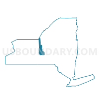
Outline

Summary
| Unique Area Identifier | 625729 |
| Name | Voting District 000000 |
| County | Cayuga County |
| State | New York |
| Area (square miles) | 128.31 |
| Land Area (square miles) | 0.00 |
| Water Area (square miles) | 128.31 |
| % of Land Area | 0.00 |
| % of Water Area | 100.00 |
| Latitude of the Internal Point | 43.53697890 |
| Longtitude of the Internal Point | -76.68703430 |
Maps


Graphs
Select a template below for downloading or customizing gragh for Voting District 000000, Cayuga County, New York


Neighbors
Neighoring Voting District (by Name) Neighboring Voting District on the Map
- Voting District 000000, Jefferson County, NY
- Voting District 000000, Oswego County, NY
- Voting District 000000, Wayne County, NY
- Voting District 130003, Oswego County, NY
- Voting District 150004, Wayne County, NY
- Voting District 200001, Cayuga County, NY
- Voting District 200002, Cayuga County, NY
Top 10 Neighboring County Subdivision (by Population) Neighboring County Subdivision on the Map
- Oswego town, Oswego County, NY (7,984)
- Wolcott town, Wayne County, NY (4,453)
- Sterling town, Cayuga County, NY (3,040)
- County subdivisions not defined, Cayuga County, NY (0)
- County subdivisions not defined, Wayne County, NY (0)
- County subdivisions not defined, Oswego County, NY (0)
- County subdivisions not defined, Jefferson County, NY (0)
Top 10 Neighboring Place (by Population) Neighboring Place on the Map
Top 10 Neighboring Unified School District (by Population) Neighboring Unified School District on the Map
- Oswego City School District, NY (33,089)
- Hannibal Central School District, NY (8,212)
- Red Creek Central School District, NY (5,516)
- School District Not Defined (Water), NY (0)
Top 10 Neighboring State Legislative District Lower Chamber (by Population) Neighboring State Legislative District Lower Chamber on the Map
- Assembly District 122, NY (131,778)
- Assembly District 124, NY (130,736)
- Assembly District 128, NY (126,373)
Top 10 Neighboring State Legislative District Upper Chamber (by Population) Neighboring State Legislative District Upper Chamber on the Map
- State Senate District 54, NY (302,881)
- State Senate District 49, NY (296,854)
- State Senate District 48, NY (294,748)
Top 10 Neighboring 111th Congressional District (by Population) Neighboring 111th Congressional District on the Map
Top 10 Neighboring Census Tract (by Population) Neighboring Census Tract on the Map
- Census Tract 214.01, Oswego County, NY (7,984)
- Census Tract 401, Cayuga County, NY (4,700)
- Census Tract 215.02, Wayne County, NY (4,453)
- Census Tract 9900, Oswego County, NY (0)
- Census Tract 9900.01, Jefferson County, NY (0)
- Census Tract 9901, Wayne County, NY (0)
- Census Tract 9902, Cayuga County, NY (0)